
Kumara Parvatha Trek Elevation Map
Kumara Parvatha
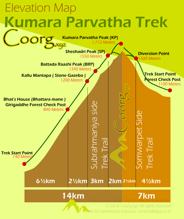
The 14 km trail from Kukke involves a steep 1,500 m climb, starting at just 140 m elevation. In contrast, Beedehalli starts at 1,100 m and reaches the peak with a gentler 600 m ascent over 7 km—making it the easier option overall.